Tourism in the ecologic reservate Antisana
Tourism in the ecologic reservate Antisana
CC
Antisana Ecological Reserve
The Antisana Ecological Reserve is in the Napo province, just 45 km from Quito.
The reserve has an area of 120,000 hectares and was created on August 31, 1993 with Official Gazette 265.
The active volcano Antisana with 5753 m high gives its name to the reserve.
You can reach the reserve from Quito and from Tena, where there are specialized agencies and guides to accompany you.
Antisana is a majestic and mysterious volcano in the Eastern Cordillera.
It is the nucleus of this protected area in whose interior there are páramos and eastern Andean forests. Volcanic activity, the passage and retreat of glaciers, and evolution have created impressive landscapes and highly diverse wildlife in its territory.
As a mirror of the volcano is the Laguna de la Mica, where part of the water for the city of Quito comes from. Apart from the lagoon, there are swampy areas where the water floods during the rainy season, forming seasonal lagoons such as Santa Lucía or Mauca Machay.
The rivers are born in the reserve that later slide down the eastern slopes and go to feed the Coca and Napo rivers; In the Tambo valley there are hot springs. Until a few years ago it was difficult to access, but now it is one of the easiest areas to visit from the country's capital and other surrounding areas.
Other Natural o Protected Areas and Spots
Galapagos - Llanganates - Ilinizas - Chimborazo - Sangay - Yasuni - Cuyabeno - Machalilla - Cotopaxi
Cotopaxi Paramo Areas Protegidas
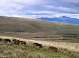
Caballos Cotopaxi Parque Nacional
Áreas Protegidas
How to get there
Take the road Quito - Sangolquí - Píntag. From the central park of Píntag, continue along the road to the Antisana volcano (suitable for all types of vehicles) until you reach the La Mica checkpoint, which is 35 kilometers and 45 minutes away (from Píntag).
To the Tambo. From the Quito – Papallacta road (73 km) you reach the Valle del Tambo community, 5 kilometers before Papallacta, from where it connects with the well-known “Ruta del Cóndor” and the reserve control booth.
The Reserve's biodiversity figures are remarkable: 418 species of birds, 73 of mammals and 61 of amphibians and reptiles.
The reserve has its own species of amphibian, the Antisana Osmanotoad, a brown-colored miniature that lives among the rocks of the páramo, very rare to find and in danger of extinction.
In the páramo there are also spectacled bears, cervicabras, white-tailed deer, dwarf deer, mountain tapirs, pumas, Andean cats, wolves, condors, curiquingues, Andean gulls, lizards, and guagsas.
Antisana Volcano (5,758 m)
It is undoubtedly one of the most beautiful and unique elevations in Ecuador. It is wide and its two summits are almost always covered with snow. The volcano is surrounded by huge expanses of páramos that begin near the town of Píntag to the east of Quito.
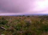
Wasteland - páramo
All the volcanoes in Ecuador have páramos, and each one has different characteristics. In the case of the Antisana moors, there are extensive moors of pads. These are small plants that grow in dense colonies and create a microclimate that is slightly warmer than the surrounding (which is usually very cold). This forms a "biothermal dome" that produces a small but constant flow of heat to shelter the roots and young stems.
La Mica Lagoon
It is of glacial origin and is currently dammed, because there the Municipal Drinking Water Company of Quito built a reservoir thanks to which water is supplied to a quarter of the population of the capital. The lagoon is a spectacle that mixes the engineering of the dam with the benefits of nature, since ducks, chupiles and coots swim in its cold but nutritious waters. Gulls, ligles, bandurrias and some migratory birds such as spur-billed sandpipers and long-legged plovers fly and nest in its surroundings.
Fuentes: areasprotegidas.ambiente.gob.ec
Tena is the capital of the Napo province. The city of Tena has 21,000 inhabitants.
Archidona is located in the north near Tena, and has different tourist attractions.
Papallacta is visited for its thermal pools, its natural resources and its typical foods. Papallacta belongs to the province of Napo and is only an hour away by interprovincial buses or with your own car from Quito.


